Geolocate

Aneto topographic map

Click on the map to display elevation.

About this map

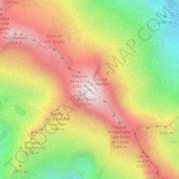
Name: Aneto topographic map, elevation, terrain.

Location: Aneto, Benasque/Benás, La Ribagorza, Huesca, Aragon, Spain (42.63102 0.65660 42.63112 0.65670)

Average elevation: 2,925 m

Minimum elevation: 2,378 m

Maximum elevation: 3,405 m

Gear up for your next adventure:

🐕Hiking Dog Pack - Let your canine companion carry their own water and food
Camping Groundsheet - Protect your tent from moisture and dirt
🥾Hiking Boots - Sturdy boots providing ankle support and traction on rugged trails
🪑Insulated Seat Pad - Protect your seat from cold rocks and wet logs
🔋Lithium AA Batteries - Long-lasting power that performs in extreme cold

As an Amazon Associate, this site earns from qualifying purchases at no extra cost to you.