
Make a donation
Gear up for your next adventure:
As an Amazon Associate, this site earns from qualifying purchases at no extra cost to you.
Naokhrebi topographic map
Click on the map to display elevation.
Make a donation
Gear up for your next adventure:
As an Amazon Associate, this site earns from qualifying purchases at no extra cost to you.
About this map
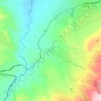
Name: Naokhrebi topographic map, elevation, terrain.
Average elevation: 1,192 m
Minimum elevation: 1,050 m
Maximum elevation: 1,481 m
Make a donation
Gear up for your next adventure:
As an Amazon Associate, this site earns from qualifying purchases at no extra cost to you.
Other topographic maps
Click on a map to view its topography, its elevation and its terrain.
Akhaltsikhe
Georgia > Samtskhe-Javakheti > Akhaltsikhe Municipality
The highland environment between Akhaltsikhe and Aspindza presents a varied and complex array of archaeological features in different locations, elevations and topographies. This includes the alluvial flood-plain of the Kura River, all the way to the high grasslands.
Average elevation: 1,123 m