Geolocate

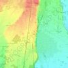
Cameri topographic map

Click on the map to display elevation.

About this map

Name: Cameri topographic map, elevation, terrain.

Location: Cameri, Novara, Piemonte, 28062, Italia (45.47500 8.60846 45.55617 8.71940)

Average elevation: 168 m

Minimum elevation: 127 m

Maximum elevation: 213 m

Other topographic maps

Click on a map to view its topography, its elevation and its terrain.

Coiromonte

Italia > Piemonte > Novara

Average elevation: 739 m

Fosseno

Italia > Piemonte > Novara

Average elevation: 548 m

Gaggiolo

Italia > Piemonte > Novara

Average elevation: 211 m

Tabarino

Italia > Piemonte > Novara

Average elevation: 555 m

Gear up for your next adventure:

🧢Beanie Hat - Keep your head warm in cold weather
🧢Outdoor Visor - Breathable visor for sunny hikes
🛶Kayak Dry Bag - Waterproof storage for kayaking adventures
🔨Vehicle Emergency Tool - Safety tool for remote road trips to trailheads
🛏️Camping Sleeping Mat - Comfortable mats for sleeping outdoors

As an Amazon Associate, this site earns from qualifying purchases at no extra cost to you.