Geolocate

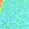
Santa Elena topographic map

Click on the map to display elevation.

About this map

Name: Santa Elena topographic map, elevation, terrain.

Location: Santa Elena, District I, Marikina, Eastern Manila District, Metro Manila, 1800, Philippines (14.62916 121.09342 14.63479 121.10591)

Average elevation: 13 m

Minimum elevation: 3 m

Maximum elevation: 50 m

Other topographic maps

Click on a map to view its topography, its elevation and its terrain.

Marikina River Park

Philippines > Marikina

Average elevation: 14 m

Marikina Riverbanks

Philippines > Marikina

Average elevation: 26 m

flood prone

Philippines > Marikina

Average elevation: 27 m

Gear up for your next adventure:

⛺Camping Tent - Weather-resistant tents suitable for 2 to 6 people
🔨Vehicle Emergency Tool - Safety tool for remote road trips to trailheads
🧦Outdoor Socks - Durable socks designed for hiking and outdoor sports
🪑Ultralight Camping Stool - Compact seating for rest stops during long hikes
🦶Hiking Shoe Insoles - Added support for high arches and long days on feet

As an Amazon Associate, this site earns from qualifying purchases at no extra cost to you.