Geolocate

Beaumesnil topographic map

Click on the map to display elevation.

About this map
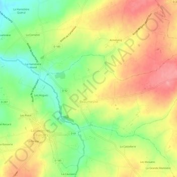
Name: Beaumesnil topographic map, elevation, terrain.

Location: Beaumesnil, Vire, Calvados, Normandy, Metropolitan France, 14380, France (48.88631 -0.99746 48.90772 -0.93825)

Average elevation: 110 m

Minimum elevation: 60 m

Maximum elevation: 155 m

Other topographic maps

Click on a map to view its topography, its elevation and its terrain.
Omaha Beach

France > Normandy > Calvados > Vierville-sur-Mer

Average elevation: 21 m

Rauray

France > Normandy > Calvados > Tessel

Average elevation: 106 m

Gear up for your next adventure:

☕Camping Coffee Maker - Brew fresh coffee anywhere on the topographic map
🛁Quick-Dry Microfiber Towel - Space-saving towel that dries rapidly on the move
🕶️Polarized Sunglasses - Reduces glare from snow and water at high elevations
🌬️Windproof Camp Stove - Efficient cooking even on exposed mountain peaks
🧢Outdoor Cap - Protective cap for sun and rain during hikes

As an Amazon Associate, this site earns from qualifying purchases at no extra cost to you.