
Thank you for supporting this site ❤️
Make a donation
Make a donation
Gear up for your next adventure:
As an Amazon Associate, this site earns from qualifying purchases at no extra cost to you.
Casali topographic map
Click on the map to display elevation.
Thank you for supporting this site ❤️
Make a donation
Make a donation
Gear up for your next adventure:
As an Amazon Associate, this site earns from qualifying purchases at no extra cost to you.
About this map
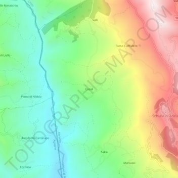
Name: Casali topographic map, elevation, terrain.
Location: Casali, Schiavi di Abruzzo, Chieti, Abruzzo, 66045, Italy (41.80116 14.44208 41.84116 14.48208)
Average elevation: 734 m
Minimum elevation: 397 m
Maximum elevation: 1,265 m
Thank you for supporting this site ❤️
Make a donation
Make a donation
Gear up for your next adventure:
As an Amazon Associate, this site earns from qualifying purchases at no extra cost to you.