Geolocate

Mechuka topographic map

Click on the map to display elevation.

About this map

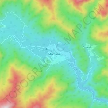
Name: Mechuka topographic map, elevation, terrain.

Location: Mechuka, Mechuka ADC, Shi Yomi, Arunachal Pradesh, India (28.55875 94.09358 28.63875 94.17358)

Average elevation: 2,165 m

Minimum elevation: 1,886 m

Maximum elevation: 2,862 m

Gear up for your next adventure:

🎒Hiking Backpack - Lightweight and ergonomic backpacks for day hikes or multi-day treks
Family Camping Tent - Spacious tent suitable for family camping trips
🚑Survival Whistle - Signal for help across long distances in mountains
🧊Portable Cooler - Keep food and drinks cold during outdoor adventures
🧦Hiking Liner Socks - Thin base layer to prevent friction and blisters

As an Amazon Associate, this site earns from qualifying purchases at no extra cost to you.