Geolocate

Omiš topographic map

Click on the map to display elevation.

About this map

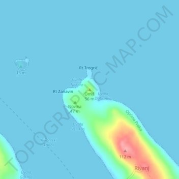
Name: Omiš topographic map, elevation, terrain.

Location: Omiš, Općina Preko, Zadar County, 23291, Croatia (44.16743 15.02483 44.16753 15.02493)

Average elevation: 8 m

Minimum elevation: -1 m

Maximum elevation: 99 m

Gear up for your next adventure:

🧶550 Survival Paracord - Versatile utility cord for emergency repairs and rigging
🥾Trail Hiking Shoes - Durable shoes designed for rugged trails
🧣Evaporative Cooling Towel - Beat the heat during intense summer climbs
🧦Thermal Socks - Warm socks for winter hiking or camping
🧥Softshell Hiking Jacket - The perfect balance of wind protection and breathability

As an Amazon Associate, this site earns from qualifying purchases at no extra cost to you.