Geolocate

Alae topographic map

Click on the map to display elevation.

About this map

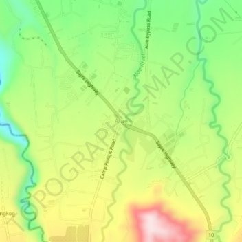
Name: Alae topographic map, elevation, terrain.

Location: Alae, Manolo Fortich, Bukidnon, Northern Mindanao, Philippines (8.40263 124.79425 8.44263 124.83425)

Average elevation: 413 m

Minimum elevation: 245 m

Maximum elevation: 620 m

Other topographic maps

Click on a map to view its topography, its elevation and its terrain.

Alae River

Philippines > Bukidnon > Manolo Fortich

Average elevation: 337 m

Mangima River

Philippines > Bukidnon > Manolo Fortich

Average elevation: 410 m

Gear up for your next adventure:

🪑Ultralight Camping Stool - Compact seating for rest stops during long hikes
🛶Kayak Dry Bag - Waterproof storage for kayaking adventures
🧼Biodegradable Camp Soap - Environmentally friendly cleaning for gear and body
🕶️Polarized Sunglasses - Reduces glare from snow and water at high elevations
🥾Hiking Shorts - Breathable shorts suitable for summer hikes

As an Amazon Associate, this site earns from qualifying purchases at no extra cost to you.