Geolocate

Songgom topographic map

Click on the map to display elevation.

About this map

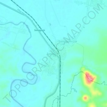
Name: Songgom topographic map, elevation, terrain.

Location: Songgom, Brebes, Central Java, Indonesia (-7.05426 108.97419 -7.01426 109.01419)

Average elevation: 29 m

Minimum elevation: 12 m

Maximum elevation: 133 m

Other topographic maps

Click on a map to view its topography, its elevation and its terrain.

Gear up for your next adventure:

🥾Light Trekking Boots - Supportive boots for multi-day treks
🦟Insect Repellent - Keep mosquitoes and black flies away in wooded areas
🎒Hiking Backpack - Lightweight and ergonomic backpacks for day hikes or multi-day treks
🩹Compact First Aid Kit - Pre-packed essentials for common trail injuries
🧣Merino Neck Gaiter - Protects against wind, sun, and cold at high altitudes

As an Amazon Associate, this site earns from qualifying purchases at no extra cost to you.