
Thank you for supporting this site ❤️
Make a donation
Make a donation
Gear up for your next adventure:
As an Amazon Associate, this site earns from qualifying purchases at no extra cost to you.
Ilmaten topographic map
Click on the map to display elevation.
Thank you for supporting this site ❤️
Make a donation
Make a donation
Gear up for your next adventure:
As an Amazon Associate, this site earns from qualifying purchases at no extra cost to you.
About this map
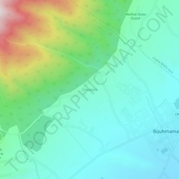
Name: Ilmaten topographic map, elevation, terrain.
Location: Ilmaten, Bouhmama, Daïra Bouhmama, Khenchela, 40007, Algérie (35.30813 6.70570 35.34813 6.74570)
Average elevation: 1,339 m
Minimum elevation: 1,112 m
Maximum elevation: 2,029 m
Thank you for supporting this site ❤️
Make a donation
Make a donation
Gear up for your next adventure:
As an Amazon Associate, this site earns from qualifying purchases at no extra cost to you.