Geolocate

Jaboi topographic map

Click on the map to display elevation.

About this map

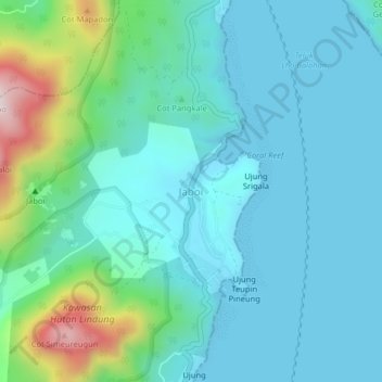
Name: Jaboi topographic map, elevation, terrain.

Location: Jaboi, Sabang, Aceh, Sumatra, Indonesia (5.78377 95.32024 5.82377 95.36024)

Average elevation: 104 m

Minimum elevation: 0 m

Maximum elevation: 563 m

Other topographic maps

Click on a map to view its topography, its elevation and its terrain.

Pulau Weh

Indonesia > Aceh > Sabang

Average elevation: 46 m

Pulau Weh

Indonesia > Aceh > Sabang

Average elevation: 46 m

Gear up for your next adventure:

Tent Footprint - Protect tent floor and increase durability
🎒Hiking Backpack - Lightweight and ergonomic backpacks for day hikes or multi-day treks
🥾Mountain Hiking Boots - High-traction boots for rocky terrain
🧊Portable Cooler - Keep food and drinks cold during outdoor adventures
🧥Waterproof Hiking Jacket - Protect yourself from rain and wind while hiking

As an Amazon Associate, this site earns from qualifying purchases at no extra cost to you.