
Thank you for supporting this site ❤️
Make a donation
Make a donation
Gear up for your next adventure:
As an Amazon Associate, this site earns from qualifying purchases at no extra cost to you.
Lichtenweg topographic map
Click on the map to display elevation.
Thank you for supporting this site ❤️
Make a donation
Make a donation
Gear up for your next adventure:
As an Amazon Associate, this site earns from qualifying purchases at no extra cost to you.
About this map
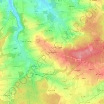
Name: Lichtenweg topographic map, elevation, terrain.
Location: Lichtenweg, Isen, Landkreis Erding, Bayern, 83558, Deutschland (48.15283 12.05283 48.19283 12.09283)
Average elevation: 585 m
Minimum elevation: 525 m
Maximum elevation: 642 m
Thank you for supporting this site ❤️
Make a donation
Make a donation
Gear up for your next adventure:
As an Amazon Associate, this site earns from qualifying purchases at no extra cost to you.