Geolocate

Santa Cruz topographic map

Click on the map to display elevation.

About this map

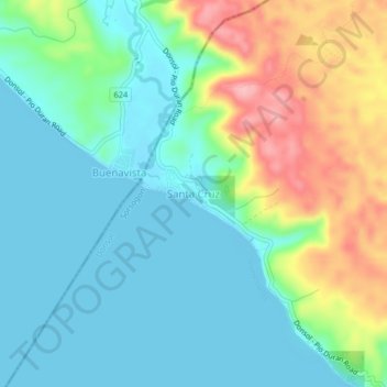
Name: Santa Cruz topographic map, elevation, terrain.

Location: Santa Cruz, Donsol, Sorsogon, Bicol Region, Philippines (12.96745 123.46781 13.00745 123.50781)

Average elevation: 41 m

Minimum elevation: -1 m

Maximum elevation: 141 m

Gear up for your next adventure:

🧭GPS Tracker - Track your location in remote areas safely
Camping Coffee Maker - Brew fresh coffee anywhere on the topographic map
🧢Hiking Sun Hat - Wide-brimmed protection for exposed mountain ridges
🕶️Polarized Sunglasses - Reduces glare from snow and water at high elevations
🥾Trail Hiking Boots - Supportive boots for rough trails

As an Amazon Associate, this site earns from qualifying purchases at no extra cost to you.