Geolocate

Jamji topographic map

Click on the map to display elevation.

About this map

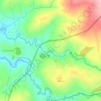
Name: Jamji topographic map, elevation, terrain.

Location: Jamji, Chaik ward, Belgut, Kericho County, Kenya (-0.48660 35.16330 -0.44660 35.20330)

Average elevation: 1,762 m

Minimum elevation: 1,687 m

Maximum elevation: 1,873 m

Gear up for your next adventure:

🥫Freeze-Dried Meals - Lightweight, high-calorie nutrition for multi-day treks
🧴First Aid Kit - Essential first aid supplies for outdoor emergencies
🧭Orienteering Kit - Tools for map reading and navigation in the wild
🔭Compact Binoculars - Lightweight optics for scouting trails and wildlife
🥾Trail Hiking Socks - Comfortable socks to prevent blisters and fatigue

As an Amazon Associate, this site earns from qualifying purchases at no extra cost to you.