Geolocate

Rosceto topographic map

Click on the map to display elevation.

About this map

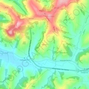
Name: Rosceto topographic map, elevation, terrain.

Location: Rosceto, Todi, Perugia, Umbria, 06059, Italy (42.71320 12.46232 42.75320 12.50232)

Average elevation: 248 m

Minimum elevation: 183 m

Maximum elevation: 356 m

Gear up for your next adventure:

🥾Trail Running Shoes - Lightweight and durable shoes for trail running
🎒Hiking Daypack - Lightweight and durable backpacks for day trips and excursions
💡Solar Camping Lamp - Eco-friendly lighting for campsites
🕶️Polarized Sunglasses - Reduces glare from snow and water at high elevations
🥾Waterproof Hiking Shoes - Durable shoes for wet and rugged trails

As an Amazon Associate, this site earns from qualifying purchases at no extra cost to you.