
Thank you for supporting this site ❤️
Make a donation
Make a donation
Gear up for your next adventure:
As an Amazon Associate, this site earns from qualifying purchases at no extra cost to you.
Babenhausen topographic map
Click on the map to display elevation.
Thank you for supporting this site ❤️
Make a donation
Make a donation
Gear up for your next adventure:
As an Amazon Associate, this site earns from qualifying purchases at no extra cost to you.
About this map
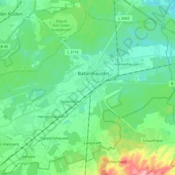
Name: Babenhausen topographic map, elevation, terrain.
Location: Babenhausen, Landkreis Darmstadt-Dieburg, Hesse, 64832, Germany (49.91064 8.86495 50.00194 9.02669)
Average elevation: 139 m
Minimum elevation: 106 m
Maximum elevation: 249 m
Thank you for supporting this site ❤️
Make a donation
Make a donation
Gear up for your next adventure:
As an Amazon Associate, this site earns from qualifying purchases at no extra cost to you.