Geolocate

Sommarnes topographic map

Click on the map to display elevation.

About this map

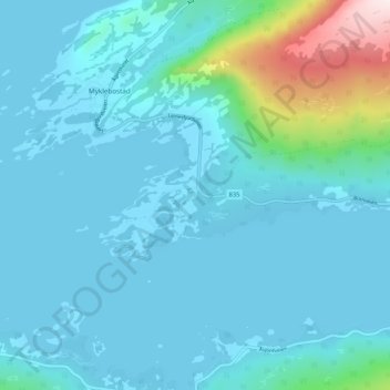
Name: Sommarnes topographic map, elevation, terrain.

Location: Sommarnes, Myklebostad, Steigen, Nordland, Norway (67.74484 15.02063 67.78484 15.06063)

Average elevation: 64 m

Minimum elevation: -1 m

Maximum elevation: 541 m

Gear up for your next adventure:

🥾Durable Hiking Shoes - Long-lasting shoes for frequent hiking
🧭Orienteering Kit - Tools for map reading and navigation in the wild
🧢Outdoor Visor - Breathable visor for sunny hikes
🛌Insulated Sleeping Pad - Critical thermal barrier between you and the cold ground
🧴Waterproofing Spray - Restore the DWR coating on jackets and tents

As an Amazon Associate, this site earns from qualifying purchases at no extra cost to you.