Geolocate

Leadville topographic map

Click on the map to display elevation.

About this map

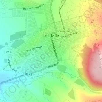
Name: Leadville topographic map, elevation, terrain.

Location: Leadville, Lake County, Colorado, 80461, United States (39.23730 -106.30754 39.25598 -106.27958)

Average elevation: 3,106 m

Minimum elevation: 3,023 m

Maximum elevation: 3,247 m

Other topographic maps

Click on a map to view its topography, its elevation and its terrain.

Lake Creek

United States > Colorado > Lake County

Average elevation: 3,293 m

Mount Evans

United States > Colorado > Lake County

Average elevation: 3,828 m

Gear up for your next adventure:

🧰Emergency Multi-Tool - Compact multi-tool for outdoor survival
🔭Outdoor Binoculars - Lightweight binoculars for birdwatching and hiking
💧Reusable Water Bottle - Durable water bottles for hydration on trails
🧭Orienteering Kit - Tools for map reading and navigation in the wild
💡Portable Camping Lamp - Rechargeable lamp for campsite lighting

As an Amazon Associate, this site earns from qualifying purchases at no extra cost to you.