Geolocate

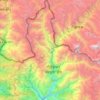
Tsho Rolpa Lake topographic map

Click on the map to display elevation.

Tsho Rolpa Lake

Tsho Rolpa (also Cho Rolpa) is one of the biggest glacial lakes in Nepal. The lake, which is located at an altitude of 4,580 metres (15,030 ft) in the Rolwaling Valley, Dolakha District, has grown considerably over the last 50 years due to glacial melting in the Himalayas.

Wikipedia (CC-BY-SA 3.0)

About this map

Name: Tsho Rolpa Lake topographic map, elevation, terrain.

Location: Tsho Rolpa Lake, Gaurishankar-09, Gaurishankar, Dolakha, Bagmati Province, Nepal (27.84907 86.46291 27.87124 86.48988)

Average elevation: 4,897 m

Minimum elevation: 4,480 m

Maximum elevation: 6,271 m

Other topographic maps

Click on a map to view its topography, its elevation and its terrain.

Jiri

Nepal > Bagmati Province > Dolakha

Average elevation: 2,496 m

Sailung

Nepal > Bagmati Province > Dolakha

Average elevation: 1,977 m

Sailung-01

Nepal > Bagmati Province > Dolakha

Average elevation: 2,336 m

Bigu

Nepal > Bagmati Province > Dolakha

Average elevation: 3,913 m

Gear up for your next adventure:

🔨Vehicle Emergency Tool - Safety tool for remote road trips to trailheads
🛰️Satellite Messenger - Emergency communication for areas with no cell service
🧢Beanie Hat - Keep your head warm in cold weather
🥾Trail Running Boots - Durable shoes designed for trail running
🧊Insulated Water Bottle - Keeps drinks cold in summer and prevents freezing in winter

As an Amazon Associate, this site earns from qualifying purchases at no extra cost to you.