Geolocate

Hingane topographic map

Click on the map to display elevation.

About this map

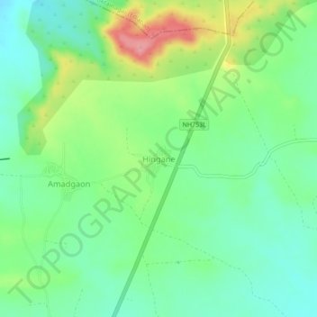
Name: Hingane topographic map, elevation, terrain.

Location: Hingane, Bodvad, Jalgaon District, Maharashtra, India (20.91418 76.01139 20.95418 76.05139)

Average elevation: 312 m

Minimum elevation: 278 m

Maximum elevation: 377 m

Gear up for your next adventure:

🥘Camping Cookware Set - Compact nesting pots and pans for trail cooking
🧥Packable Rain Jacket - Breathable waterproof layer for unpredictable weather
❄️Traction Ice Cleats - Slip-on spikes for icy trails and winter hiking
🧴First Aid Kit - Essential first aid supplies for outdoor emergencies
🧥Softshell Jacket - Windproof and breathable jacket for hiking

As an Amazon Associate, this site earns from qualifying purchases at no extra cost to you.