Geolocate

Cairo topographic map

Click on the map to display elevation.

About this map

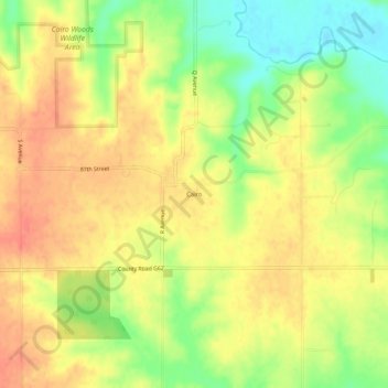
Name: Cairo topographic map, elevation, terrain.

Location: Cairo, Louisa County, Iowa, United States (41.16364 -91.34738 41.20364 -91.30738)

Average elevation: 212 m

Minimum elevation: 179 m

Maximum elevation: 234 m

Gear up for your next adventure:

🥾Mountain Trail Shoes - High-traction shoes for mountain trails
🧊Insulated Water Bottle - Keeps drinks cold in summer and prevents freezing in winter
🔭Compact Binoculars - Lightweight optics for scouting trails and wildlife
🧥Softshell Hiking Jacket - The perfect balance of wind protection and breathability
🧼Travel Hand Sanitizer - Keep hands clean when water is scarce

As an Amazon Associate, this site earns from qualifying purchases at no extra cost to you.