
Lake Norden topographic map
Interactive map
Click on the map to display elevation.
About this map
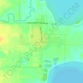
Name: Lake Norden topographic map, elevation, terrain.
Location: Lake Norden, Hamlin County, South Dakota, United States (44.57221 -97.21934 44.58913 -97.19852)
Average elevation: 509 m
Minimum elevation: 499 m
Maximum elevation: 524 m
Other topographic maps
Click on a map to view its topography, its elevation and its terrain.
Lake Poinsett
United States > South Dakota > Hamlin County
Lake Poinsett, Norden Township, Hamlin County, South Dakota, United States
Average elevation: 506 m
Alsville
United States > South Dakota > Hamlin County
Alsville, Norden Township, Hamlin County, South Dakota, United States
Average elevation: 513 m
Opdahl Township
United States > South Dakota > Hamlin County
Opdahl Township, Hamlin County, South Dakota, United States
Average elevation: 526 m