
Thank you for supporting this site ❤️
Make a donation
Make a donation
Gear up for your next adventure:
As an Amazon Associate, this site earns from qualifying purchases at no extra cost to you.
Rwekigyera topographic map
Click on the map to display elevation.
Thank you for supporting this site ❤️
Make a donation
Make a donation
Gear up for your next adventure:
As an Amazon Associate, this site earns from qualifying purchases at no extra cost to you.
About this map
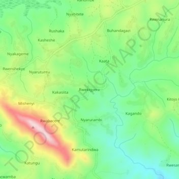
Name: Rwekigyera topographic map, elevation, terrain.
Location: Rwekigyera, Rukungiri, Western Region, Uganda (-0.88689 29.89990 -0.84689 29.93990)
Average elevation: 1,557 m
Minimum elevation: 1,433 m
Maximum elevation: 1,764 m
Thank you for supporting this site ❤️
Make a donation
Make a donation
Gear up for your next adventure:
As an Amazon Associate, this site earns from qualifying purchases at no extra cost to you.