
Mulmur topographic map
Click on the map to display elevation.
About this map
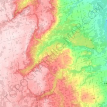
Name: Mulmur topographic map, elevation, terrain.
Location: Mulmur, Dufferin County, Central Ontario, Ontario, Canada (44.08425 -80.21214 44.29490 -79.99249)
Average elevation: 386 m
Minimum elevation: 204 m
Maximum elevation: 531 m
Dufferin County trails, hiking, mountain biking, running and outdoor activities
Other topographic maps
Click on a map to view its topography, its elevation and its terrain.