Geolocate

Cotay topographic map

Click on the map to display elevation.

About this map

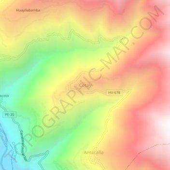
Name: Cotay topographic map, elevation, terrain.

Location: Cotay, Cosme, Churcampa, Huancavelica, Perú (-12.63069 -74.65153 -12.59069 -74.61153)

Average elevation: 3,360 m

Minimum elevation: 2,487 m

Maximum elevation: 4,092 m

Gear up for your next adventure:

🧊Portable Cooler - Keep food and drinks cold during outdoor adventures
🧶550 Survival Paracord - Versatile utility cord for emergency repairs and rigging
🦯Trekking Poles - Reduced impact on joints for steep topographic climbs
🥾Trail Hiking Socks - Comfortable socks to prevent blisters and fatigue
🩹Moleskin Blister Pads - Direct protection for painful foot pressure points

As an Amazon Associate, this site earns from qualifying purchases at no extra cost to you.