Geolocate

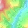
Grozny topographic map

Click on the map to display elevation.

About this map

Name: Grozny topographic map, elevation, terrain.

Location: Grozny, Chechnya, North Caucasian Federal District, Russia (43.17830 45.43240 43.43916 45.81546)

Average elevation: 183 m

Minimum elevation: 77 m

Maximum elevation: 474 m

Other topographic maps

Click on a map to view its topography, its elevation and its terrain.

Dargo

Russia > Chechnya > Vedensky District

Average elevation: 788 m

Ведучи

Russia > Chechnya > Itum-Kalinsky District

Average elevation: 1,302 m

Гуни

Russia > Chechnya > Vedensky District

Average elevation: 601 m

Бельты

Russia > Chechnya > Kurchaloyevsky District

Average elevation: 457 m

Регита

Russia > Chechnya > Kurchaloyevsky District

Average elevation: 642 m

Gear up for your next adventure:

🚲Handlebar Phone Mount - View topographic-map.com live while cycling
🥾Hiking Gaiters - Protect legs and shoes from mud, snow, and debris
💧Hydration Pack - Hands-free hydration system for long hikes
🧥Packable Rain Jacket - Breathable waterproof layer for unpredictable weather
🧊Portable Cooler - Keep food and drinks cold during outdoor adventures

As an Amazon Associate, this site earns from qualifying purchases at no extra cost to you.