Geolocate

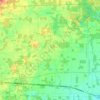
Northwest topographic map

Click on the map to display elevation.

About this map

Name: Northwest topographic map, elevation, terrain.

Location: Northwest, Northwest Township, Williams County, Ohio, United States (41.67172 -84.75329 41.71172 -84.71329)

Average elevation: 301 m

Minimum elevation: 286 m

Maximum elevation: 323 m

Other topographic maps

Click on a map to view its topography, its elevation and its terrain.
Alvordton

United States > Ohio > Williams County > Alvordton

Average elevation: 259 m

Bryan

United States > Ohio > Williams County

Average elevation: 234 m

Stryker

United States > Ohio > Williams County

Average elevation: 218 m

Gear up for your next adventure:

🗺️Topographic Maps - Detailed maps to explore trails, mountains, and wilderness areas
🧭GPS Outdoor Watch - Smart watch for navigation and fitness tracking in nature
🧳Compression Sacks - Maximize space in your backpack by shrinking gear
🥾Durable Hiking Shoes - Long-lasting shoes for frequent hiking
🧢Outdoor Visor - Breathable visor for sunny hikes

As an Amazon Associate, this site earns from qualifying purchases at no extra cost to you.