Geolocate

Fernway topographic map

Click on the map to display elevation.

About this map
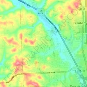
Name: Fernway topographic map, elevation, terrain.

Location: Fernway, Cranberry Township, Butler County, Pennsylvania, 16066, United States (40.67367 -80.15146 40.72286 -80.10153)

Average elevation: 331 m

Minimum elevation: 296 m

Maximum elevation: 383 m

Other topographic maps

Click on a map to view its topography, its elevation and its terrain.

Gear up for your next adventure:

🎒Hiking Backpack - Lightweight and ergonomic backpacks for day hikes or multi-day treks
🧥Packable Rain Jacket - Breathable waterproof layer for unpredictable weather
🥾Trail Hiking Boots - Supportive boots for rough trails
🛰️Satellite Messenger - Emergency communication for areas with no cell service
🛌Down Sleeping Bag - Superior warmth-to-weight ratio for cold nights

As an Amazon Associate, this site earns from qualifying purchases at no extra cost to you.