Geolocate

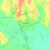
Oak Forest topographic map

Click on the map to display elevation.

About this map

Name: Oak Forest topographic map, elevation, terrain.

Location: Oak Forest, Gonzales County, Texas, United States (29.47885 -97.60472 29.51885 -97.56472)

Average elevation: 108 m

Minimum elevation: 92 m

Maximum elevation: 137 m

Other topographic maps

Click on a map to view its topography, its elevation and its terrain.
Gonzales

United States > Texas > Gonzales County

Average elevation: 92 m

Waelder

United States > Texas > Gonzales County

Average elevation: 118 m

Smiley

United States > Texas > Gonzales County > Smiley

Average elevation: 90 m

Gear up for your next adventure:

🥾Approach Boots - Comfortable boots for hiking and climbing approaches
🚑Survival Whistle - Signal for help across long distances in mountains
🥾Mountaineering Boots - Supportive boots for climbing and high-altitude hiking
⛺Family Camping Tent - Spacious tent suitable for family camping trips
🛰️Satellite Messenger - Emergency communication for areas with no cell service

As an Amazon Associate, this site earns from qualifying purchases at no extra cost to you.