
Thank you for supporting this site ❤️
Make a donation
Make a donation
Gear up for your next adventure:
As an Amazon Associate, this site earns from qualifying purchases at no extra cost to you.
Fonte topographic map
Click on the map to display elevation.
Thank you for supporting this site ❤️
Make a donation
Make a donation
Gear up for your next adventure:
As an Amazon Associate, this site earns from qualifying purchases at no extra cost to you.
About this map
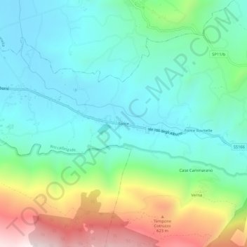
Name: Fonte topographic map, elevation, terrain.
Location: Fonte, Roccadaspide, Salerno, Campania, 84044, Italia (40.43663 15.09176 40.47663 15.13176)
Average elevation: 259 m
Minimum elevation: 33 m
Maximum elevation: 838 m
Thank you for supporting this site ❤️
Make a donation
Make a donation
Gear up for your next adventure:
As an Amazon Associate, this site earns from qualifying purchases at no extra cost to you.