Geolocate

Tenna topographic map

Click on the map to display elevation.

About this map

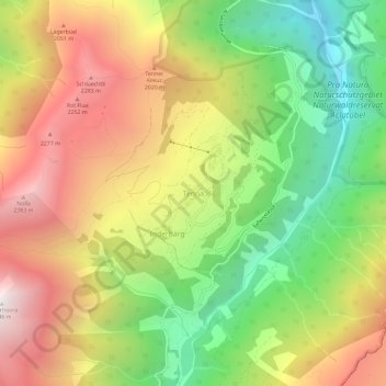
Name: Tenna topographic map, elevation, terrain.

Location: Tenna, Safiental, Surselva, Grisons, 7106, Switzerland (46.72698 9.31903 46.76698 9.35903)

Average elevation: 1,617 m

Minimum elevation: 796 m

Maximum elevation: 2,513 m

Gear up for your next adventure:

🧴Waterproofing Spray - Restore the DWR coating on jackets and tents
🚲Bike Repair Kit - Essential tools for on-trail mechanical issues
🔥Emergency Fire Starter - Reliable ignition source for all weather conditions
🕯️Camping Lantern - Illuminates your entire campsite with high-efficiency LEDs
🥾Mountain Trail Shoes - High-traction shoes for mountain trails

As an Amazon Associate, this site earns from qualifying purchases at no extra cost to you.