Geolocate

Jubbar topographic map

Click on the map to display elevation.

About this map

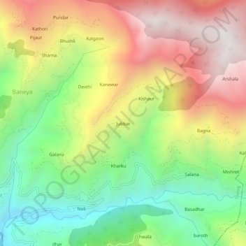
Name: Jubbar topographic map, elevation, terrain.

Location: Jubbar, Theog, Shimla, Himachal Pradesh, 171226, India (30.99664 77.42214 31.03664 77.46214)

Average elevation: 1,915 m

Minimum elevation: 1,243 m

Maximum elevation: 2,686 m

Gear up for your next adventure:

🥾Hiking Gaiters - Protect legs and shoes from mud, snow, and debris
🩹Moleskin Blister Pads - Direct protection for painful foot pressure points
💧Filtered Water Bottle - Safe drinking water on the go
🧴Bear Spray Holster - Quick-access carry for essential Canadian wilderness safety
🥾Trail Hiking Shoes - Durable shoes designed for rugged trails

As an Amazon Associate, this site earns from qualifying purchases at no extra cost to you.