
Thank you for supporting this site ❤️
Make a donation
Make a donation
Gear up for your next adventure:
As an Amazon Associate, this site earns from qualifying purchases at no extra cost to you.
Viduedo topographic map
Click on the map to display elevation.
Thank you for supporting this site ❤️
Make a donation
Make a donation
Gear up for your next adventure:
As an Amazon Associate, this site earns from qualifying purchases at no extra cost to you.
About this map
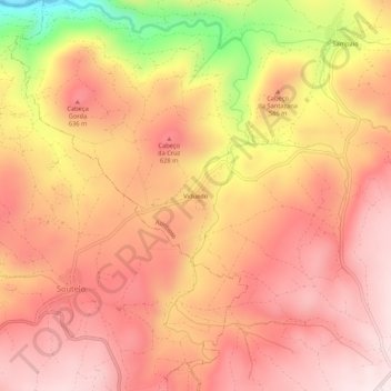
Name: Viduedo topographic map, elevation, terrain.
Location: Viduedo, Azinhoso, Mogadouro, Bragance, Portugal (41.38698 -6.73350 41.42698 -6.69350)
Average elevation: 556 m
Minimum elevation: 228 m
Maximum elevation: 711 m
Thank you for supporting this site ❤️
Make a donation
Make a donation
Gear up for your next adventure:
As an Amazon Associate, this site earns from qualifying purchases at no extra cost to you.