Geolocate

Rassetta topographic map

Click on the map to display elevation.

About this map

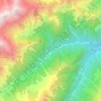
Name: Rassetta topographic map, elevation, terrain.

Location: Rassetta, Rassa, Vercelli, Piemonte, Italia (45.74723 7.96700 45.78723 8.00700)

Average elevation: 1,611 m

Minimum elevation: 917 m

Maximum elevation: 2,536 m

Gear up for your next adventure:

🥾Durable Hiking Shoes - Long-lasting shoes for frequent hiking
🧼Biodegradable Camp Soap - Environmentally friendly cleaning for gear and body
🛁Quick-Dry Microfiber Towel - Space-saving towel that dries rapidly on the move
🧤Insulated Winter Gloves - Heavy-duty protection for sub-zero Canadian adventures
🦌Outdoor Trail Camera - Monitor wildlife activity near your favorite spots

As an Amazon Associate, this site earns from qualifying purchases at no extra cost to you.