
Thank you for supporting this site ❤️
Make a donation
Make a donation
Gear up for your next adventure:
As an Amazon Associate, this site earns from qualifying purchases at no extra cost to you.
Taref topographic map
Click on the map to display elevation.
Thank you for supporting this site ❤️
Make a donation
Make a donation
Gear up for your next adventure:
As an Amazon Associate, this site earns from qualifying purchases at no extra cost to you.
About this map
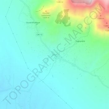
Name: Taref topographic map, elevation, terrain.
Location: Taref, Gosbat, Daïra de Ras El Aioun, Batna, Algérie (35.62767 5.43982 35.66767 5.47982)
Average elevation: 967 m
Minimum elevation: 837 m
Maximum elevation: 1,478 m
Thank you for supporting this site ❤️
Make a donation
Make a donation
Gear up for your next adventure:
As an Amazon Associate, this site earns from qualifying purchases at no extra cost to you.