
Plasmolen topographic map
Interactive map
Click on the map to display elevation.
About this map
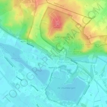
Name: Plasmolen topographic map, elevation, terrain.
Location: Plasmolen, Mook en Middelaar, Limburg, Niederlande (51.72650 5.89859 51.75229 5.93830)
Average elevation: 27 m
Minimum elevation: 6 m
Maximum elevation: 76 m
Other topographic maps
Click on a map to view its topography, its elevation and its terrain.
Mook en Middelaar
Niederlande > Limburg > Mook en Middelaar
Mook en Middelaar, Limburg, Niederlande
Average elevation: 27 m