Geolocate

Cosanga topographic map

Click on the map to display elevation.

About this map

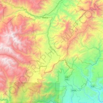
Name: Cosanga topographic map, elevation, terrain.

Location: Cosanga, Quijos, Napo, Ecuador (-0.66749 -78.17789 -0.51025 -77.79889)

Average elevation: 2,336 m

Minimum elevation: 862 m

Maximum elevation: 4,292 m

Other topographic maps

Click on a map to view its topography, its elevation and its terrain.

Puntas

Ecuador > Napo > Quijos > Cuyuja

Average elevation: 3,913 m

Gear up for your next adventure:

🧣Evaporative Cooling Towel - Beat the heat during intense summer climbs
🧢Outdoor Cap - Protective cap for sun and rain during hikes
💡Compact LED Flashlight - Powerful and portable flashlight for outdoor use
💧Hydration Pack - Hands-free hydration system for long hikes
🛏️Sleeping Bag - Warm and compact sleeping bags for outdoor camping

As an Amazon Associate, this site earns from qualifying purchases at no extra cost to you.