
Guaramirim topographic map
Click on the map to display elevation.
About this map
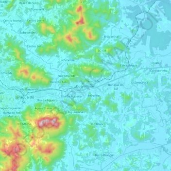
Name: Guaramirim topographic map, elevation, terrain.
Location: Guaramirim, Santa Catarina, South Region, Brazil (-26.57398 -49.05143 -26.37355 -48.83137)
Average elevation: 110 m
Minimum elevation: 2 m
Maximum elevation: 867 m
Other topographic maps
Click on a map to view its topography, its elevation and its terrain.