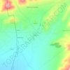
Talkhamt topographic map
Click on the map to display elevation.
About this map

Name: Talkhamt topographic map, elevation, terrain.
Location: Talkhamt, Ras El Aïoun district, Batna, 05000, Algeria (35.65191 5.67833 35.79447 5.88128)
Average elevation: 1,060 m
Minimum elevation: 807 m
Maximum elevation: 1,734 m
Other topographic maps
Click on a map to view its topography, its elevation and its terrain.
Tizi Sahraoui
Algeria > Batna > Ras El Aïoun district > Gosbat > الجريات ⵜⴰⵊⵔⵡⴰⵜ
Average elevation: 1,173 m