Geolocate

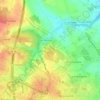
Le Maine topographic map

Click on the map to display elevation.

About this map

Name: Le Maine topographic map, elevation, terrain.

Location: Le Maine, Saintes, Charente-Maritime, Nouvelle-Aquitaine, France métropolitaine, 17100, France (45.71233 -0.64480 45.75233 -0.60480)

Average elevation: 18 m

Minimum elevation: -2 m

Maximum elevation: 57 m

Other topographic maps

Click on a map to view its topography, its elevation and its terrain.
Gear up for your next adventure:

🎒Hiking Backpack - Lightweight and ergonomic backpacks for day hikes or multi-day treks
🧥Packable Rain Jacket - Breathable waterproof layer for unpredictable weather
🔋Lithium AA Batteries - Long-lasting power that performs in extreme cold
🥾Waterproof Hiking Boots - Boots keeping your feet dry in wet conditions
🥾Mountain Hiking Shoes - Shoes with superior grip for mountainous terrain

As an Amazon Associate, this site earns from qualifying purchases at no extra cost to you.