Geolocate

Acathuta topographic map

Click on the map to display elevation.

About this map

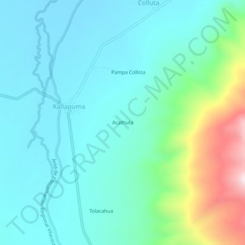
Name: Acathuta topographic map, elevation, terrain.

Location: Acathuta, Kallapuma, Tarata, Tacna, Perú (-17.33969 -69.74190 -17.29969 -69.70190)

Average elevation: 4,359 m

Minimum elevation: 4,226 m

Maximum elevation: 4,864 m

Gear up for your next adventure:

📷Outdoor Action Camera - Capture high-elevation views and rugged adventures
🪜Heavy Duty Carabiners - Multi-use clips for securing gear to your backpack
🚑Survival Whistle - Signal for help across long distances in mountains
🧥Insulated Jacket - Keep warm in cold outdoor conditions
🧼Biodegradable Camp Soap - Environmentally friendly cleaning for gear and body

As an Amazon Associate, this site earns from qualifying purchases at no extra cost to you.