Geolocate

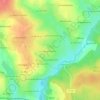
Le Coudray topographic map

Click on the map to display elevation.

About this map

Name: Le Coudray topographic map, elevation, terrain.

Location: Le Coudray, Le Bourgneuf-la-Forêt, Laval, Mayenne, Pays de la Loire, France métropolitaine, 53410, France (48.14633 -1.00305 48.18633 -0.96305)

Average elevation: 159 m

Minimum elevation: 117 m

Maximum elevation: 193 m

Other topographic maps

Click on a map to view its topography, its elevation and its terrain.
Gear up for your next adventure:

🦶Hiking Shoe Insoles - Added support for high arches and long days on feet
🥾Trail Running Boots - Durable shoes designed for trail running
💡Portable Camping Lamp - Rechargeable lamp for campsite lighting
🐕Hiking Dog Pack - Let your canine companion carry their own water and food
🥘Camping Cookware Set - Compact nesting pots and pans for trail cooking

As an Amazon Associate, this site earns from qualifying purchases at no extra cost to you.