Geolocate

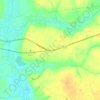
Garland topographic map

Click on the map to display elevation.

About this map

Name: Garland topographic map, elevation, terrain.

Location: Garland, Sampson County, North Carolina, United States (34.77500 -78.40681 34.79633 -78.38219)

Average elevation: 35 m

Minimum elevation: 21 m

Maximum elevation: 47 m

Other topographic maps

Click on a map to view its topography, its elevation and its terrain.
Elliott

United States > North Carolina > Sampson County

Average elevation: 35 m

Ivanhoe

United States > North Carolina > Sampson County

Average elevation: 15 m

Gear up for your next adventure:

🩹Compact First Aid Kit - Pre-packed essentials for common trail injuries
🛁Quick-Dry Microfiber Towel - Space-saving towel that dries rapidly on the move
🧭GPS Handheld Device - Reliable GPS navigation for outdoor adventures
👖Convertible Hiking Pants - Zip-off legs to adapt to changing weather conditions
🧦Hiking Socks - Moisture-wicking and comfortable socks for long hikes

As an Amazon Associate, this site earns from qualifying purchases at no extra cost to you.