
Make a donation
Gear up for your next adventure:
As an Amazon Associate, this site earns from qualifying purchases at no extra cost to you.
The Canyon topographic map
Click on the map to display elevation.
Make a donation
Gear up for your next adventure:
As an Amazon Associate, this site earns from qualifying purchases at no extra cost to you.
About this map
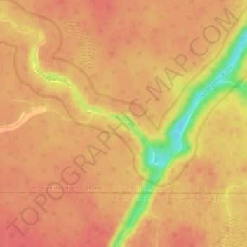
Name: The Canyon topographic map, elevation, terrain.
Average elevation: 252 m
Minimum elevation: 207 m
Maximum elevation: 265 m
Make a donation
Gear up for your next adventure:
As an Amazon Associate, this site earns from qualifying purchases at no extra cost to you.
Other topographic maps
Click on a map to view its topography, its elevation and its terrain.
Ptarmigan Lake
Canada > Ontario > Cochrane District > Unorganized North Cochrane
Average elevation: 225 m
Make a donation
Gear up for your next adventure:
As an Amazon Associate, this site earns from qualifying purchases at no extra cost to you.
Joseph Lake
Canada > Ontario > Cochrane District > Unorganized North Cochrane
Average elevation: 271 m
Moose Factory Island
Canada > Ontario > Cochrane District > Unorganized North Cochrane
Average elevation: 4 m
Wadsworth Lake
Canada > Ontario > Cochrane District > Unorganized North Cochrane
Average elevation: 323 m
Make a donation
Gear up for your next adventure:
As an Amazon Associate, this site earns from qualifying purchases at no extra cost to you.
Ghost River
Canada > Ontario > Cochrane District > Unorganized North Cochrane
Average elevation: 287 m
Kabinakagami River
Canada > Ontario > Cochrane District > Unorganized North Cochrane
Average elevation: 250 m
Ghost Lake;Pearce Creek
Canada > Ontario > Cochrane District > Unorganized North Cochrane
Average elevation: 213 m
Make a donation
Gear up for your next adventure:
As an Amazon Associate, this site earns from qualifying purchases at no extra cost to you.
Moose Factory Island
Canada > Ontario > Cochrane District > Unorganized North Cochrane
Average elevation: 4 m
Big Cedar Creek
Canada > Ontario > Cochrane District > Unorganized North Cochrane
Average elevation: 49 m