
Annauir topographic map
Interactive map
Click on the map to display elevation.
About this map
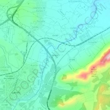
Name: Annauir topographic map, elevation, terrain.
Location: Annauir, Хатива, la Costera, Валенсия, 46670, Испания (38.95591 -0.58494 38.99591 -0.54494)
Average elevation: 162 m
Minimum elevation: 88 m
Maximum elevation: 425 m