Geolocate

Egana topographic map

Click on the map to display elevation.

About this map

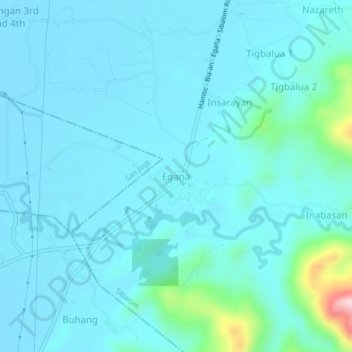
Name: Egana topographic map, elevation, terrain.

Location: Egana, Sibalom, Antique, Western Visayas, 5713, Philippines (10.72867 121.98835 10.76867 122.02835)

Average elevation: 40 m

Minimum elevation: 6 m

Maximum elevation: 309 m

Other topographic maps

Click on a map to view its topography, its elevation and its terrain.

Sibalom Natural Park

Philippines > Antique > Sibalom

Average elevation: 422 m

Gear up for your next adventure:

🎒Hiking Daypack - Lightweight and durable backpacks for day trips and excursions
Backpacking Tent - Lightweight tent for long-distance hiking trips
🧢Beanie Hat - Keep your head warm in cold weather
🧤Thermal Hiking Gloves - Grip-enhanced gloves for cold-weather altitude trekking
🥾Mountaineering Boots - Supportive boots for climbing and high-altitude hiking

As an Amazon Associate, this site earns from qualifying purchases at no extra cost to you.