Geolocate

Hawk topographic map

Click on the map to display elevation.

About this map

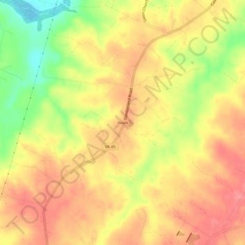
Name: Hawk topographic map, elevation, terrain.

Location: Hawk, Cumberland County, Virginia, United States (37.38987 -78.37611 37.42987 -78.33611)

Average elevation: 131 m

Minimum elevation: 84 m

Maximum elevation: 158 m

Other topographic maps

Click on a map to view its topography, its elevation and its terrain.

Gear up for your next adventure:

🥾Hiking Shorts - Breathable shorts suitable for summer hikes
🧥Insulated Jacket - Keep warm in cold outdoor conditions
🏃Hydration Running Vest - Carry water and maps close to your body for speed
🔦UV Flashlight - Detect minerals or specific insects in the dark
Family Camping Tent - Spacious tent suitable for family camping trips

As an Amazon Associate, this site earns from qualifying purchases at no extra cost to you.