
Hill Brow topographic map
Interactive map
Click on the map to display elevation.
About this map
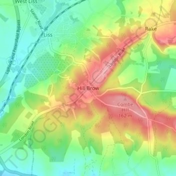
Name: Hill Brow topographic map, elevation, terrain.
Average elevation: 99 m
Minimum elevation: 53 m
Maximum elevation: 164 m
Other topographic maps
Click on a map to view its topography, its elevation and its terrain.
Selsey
Royaume-Uni > Angleterre > West Sussex > Chichester
Selsey, Chichester, West Sussex, Angleterre, Royaume-Uni
Average elevation: 1 m