
Thank you for supporting this site ❤️
Make a donation
Make a donation
Gear up for your next adventure:
As an Amazon Associate, this site earns from qualifying purchases at no extra cost to you.
Ringwood topographic map
Click on the map to display elevation.
Thank you for supporting this site ❤️
Make a donation
Make a donation
Gear up for your next adventure:
As an Amazon Associate, this site earns from qualifying purchases at no extra cost to you.
About this map
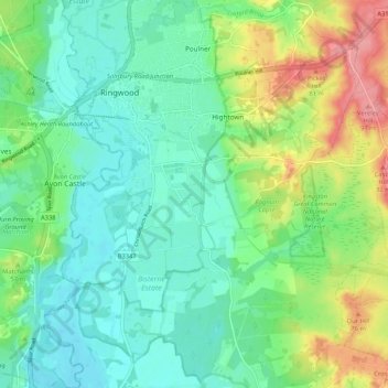
Name: Ringwood topographic map, elevation, terrain.
Location: Ringwood, New Forest, Hampshire, England, United Kingdom (50.79615 -1.81214 50.86265 -1.73266)
Average elevation: 34 m
Minimum elevation: 6 m
Maximum elevation: 96 m
Thank you for supporting this site ❤️
Make a donation
Make a donation
Gear up for your next adventure:
As an Amazon Associate, this site earns from qualifying purchases at no extra cost to you.